Mizque
Mizque, Misk'i (from Quechua: misk'i, meaning "sweet") is a town in the Cochabamba Department, Bolivia. It is the capital of the Mizque Province. Mizque is located in the valley of the Mizque River, one of the main tributaries of the Río Grande.
Historically, it was located in the region of Upper Peru, and was a corregimiente dependent on Santa Cruz de la Sierra until 1783, when it became an independent town of the Intendencia de Cochabamba, in the Viceroyalty of the Río de la Plata. During the Spanish American wars of independence, Mizque sent deputies to the Congress of Tucumán, which declared Argentina's independence in 1816, and to the congress that declared the independence of Bolivia in 1825.
Mizque is located on a well maintained highway which to the north-west leads through the Valle Alto to Cochabamba. In the other direction, as National Road 23, the route runs southwards to Aiquile and, beyond that, to Sucre.
The bus connection to Cochabamba operates on an almost daily basis.
Mizque is also positioned beside the Cochabamba-Aiquile railway line, but since the railway station is across the river it is hard for the inhabitants to access. There is a railcar service to Cochabamba that runs three times per week, but the journey time is approximately twice as long as that taken by the bus using the main road, and the station is not much used for passenger traffic.
Map - Mizque
Map
Country - Bolivia
 |
 |
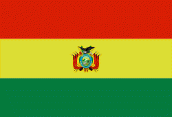
| Flag of Bolivia | |
The sovereign state of Bolivia is a constitutionally unitary state, divided into nine departments. Its geography varies from the peaks of the Andes in the West, to the Eastern Lowlands, situated within the Amazon basin. One-third of the country is within the Andean mountain range. With 1098581 km2 of area, Bolivia is the fifth largest country in South America, after Brazil, Argentina, Peru, and Colombia (and alongside Paraguay, one of the only two landlocked countries in the Americas), the 27th largest in the world, the largest landlocked country in the Southern Hemisphere, and the world's seventh largest landlocked country, after Kazakhstan, Mongolia, Chad, Niger, Mali, and Ethiopia.
Currency / Language
| ISO | Currency | Symbol | Significant figures |
|---|---|---|---|
| BOB | Boliviano | Bs | 2 |
| ISO | Language |
|---|---|
| AY | Aymara language |
| QU | Quechua language |
| ES | Spanish language |


